forestry imaging Companies
-
based in Stony Mountain, MANITOBA (CANADA)
The CropCam offers images on demand and is an inexpensive alternative to satellite or flying an airplane over a field. It can provide images for agriculture, forestry, oil & gas, surveys, mapping, land management drainage, environmental, and a ...
-
based in Wilsonville, OREGON (USA)
HoneyComb is an Oregon-based company focused on drone based aerial imaging solutions for precision agriculture and forestry. Since inception, agriculture has been our #1 market with all of our products, services, and values reflecting that. As a ...
-
based in Havant, UNITED KINGDOM
Pear Technology has been providing digital maps and mapping services to the rural sector since 1995. Recognising that mapping, CAD and GIS software available at that time was too expensive and too complicated for people whose specialisms were in ...
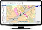
PearGIS - Desktop Based GIS Package
PearGIS is a powerful desktop based GIS package that offers simple mapping functionality with database driven ...
REQUEST QUOTEPear Technology has been providing digital maps and mapping services to the rural sector since 1995. Recognising that mapping, CAD and GIS software available at that time was too expensive and too complicated for people whose specialisms were in ...
Need help finding the right suppliers? Try XPRT Sourcing. Let the XPRTs do the work for you