
AgroMonitoring software
AgroMonitoring - Model Agro API - Satellite and Weather Data Software for Precision Farming
Through our simple and fast API, you can easily implement multi-spectrum satellite imagery, vegetation indices and weather data of the crop for the most recent day or for a day in the past to your projects.
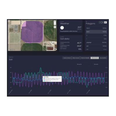
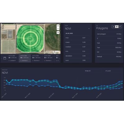
AgroMonitoring - Model Agro Dashboard - Satellite and Weather Data Software for Precision Farming
Dashboard is a visual service that helps you to monitor your field states over the year. The service allows to operate with satellite imagery and weather data along with advanced machine learning technologies. Just draw your polygon on the map and immediately get satellite imagery, NDVI, EVI, NRI, DSWI, NDWI vegetation indices statistics, Hourly and Daily weather forecasts, Historical weather data, Historical NDVI chart and others.
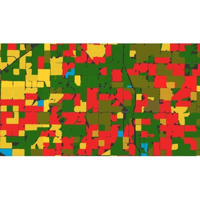
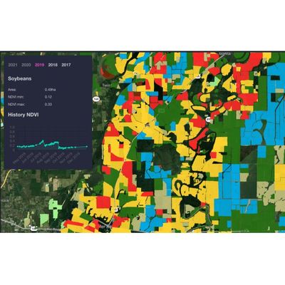
AgroMonitoring - Crop Map Sofware
Based on large amount of processing satellite and climate data, we provide analytical reports and detailed datasets for crop monitoring: Crop map (soy, corn, wheat, etc.). Recognised field boundaries. Vegetation indices statistics by each recognised field. Climate data for regions and particular field.
AgroMonitoring - Agro Analytics Software
We can customise our analytical reports for your needs. Reports include overviews of the conditions of the observed crops, distribution on the map of the type of crops and their condition, vegetation statistics, etc. Data can be stratified and aggregated by any criterion, for instance, by crops, by regions, by years.