

Grain Data Solutions Inc.
- Home
- Companies
- Grain Data Solutions Inc.
- Products
- Monitoring & Management Of Croplands By ...
Most popular related searches
cropland
farm performance
grain industry
agriculture system
agriculture industry
farming system
remote agriculture
farm insurance
farm information
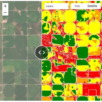
Satellite Imagery
We use a combination of optical and microwave imageries as the raw data
Artificial Intelligence
We use state of art AI models and make predictions against the ground truth datasets
Domain Expertise
Our approach is based on expertise of a team of plant science, remote sensing, and soil science PhDs
Customized Large Language Models (LLMs)
Get the best of capabilities from tools such as ChatGPT toward your business goals