

Version PIX4Dfields -Advanced Agriculture Mapping Software
Remote sensing: Collect images using a drone and any standard RGB or select multispectral cameras. You can also use Satellite Data Import to enhance your mapping experience with Sentinel-2 satellite data. Process: Process imagery with the instant processing engine and get your maps directly in the field: 6.8 GB, 2948 images, 10 min (with the new radiometry module). Scout: Generate precise orthomosaics, digital surface models, index maps, zones and accurate prescription maps. Trim your fields to a desired field boundary to create more targeted outputs. Analyze: Visualize and understand your crop growth stages and stress levels. Analyze and compare different layers of information for a full insight of your yield performance and use them to increase crop production and reduce costs. Share: Share your maps with all project stakeholders for seamless collaboration using PIX4Dfields' PDF report tool or using the share to PIX4Dcloud feature. Integrate: Download all outputs, results and insights and import them into the Farming Management Software of your choice in various industry standard formats.
Create precision agriculture maps using images from drones and satellite.
The only hybrid mapping software solution for agriculture based on knowledge from farmers, agronomists, and researchers.
In-Field Results
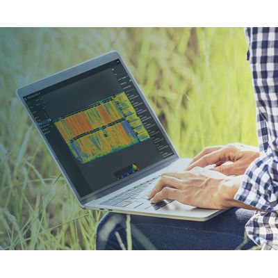
Create maps rapidly (no internet connection required) for faster decision making and action, without leaving the field.
Accurate maps:
Get maps of your fields and crops at any stage using satellite and/or drone imagery.
Trusted Results
Eliminate guesswork by analyzing crop health maps and measure issues using calibrated multispectral or full resolution RGB images.
Easy Sharing
Share your data via PIX4Dcloud, as PDF report and in industry standard formats.
Import images from any drone or satellite, captured with standard RGB or select multispectral cameras
- Multispectral images
- RGB cameras, drone images
- Satellite images
- Use any camera and farm mapping software
- Modified cameras and other cameras
Create and analyze real time maps of your crops to enhance your agriculture workflow
Easily scout your farm and generate the appropriate output for your needs
Orthomosaic
Field boundaries
Vegetation index map
Digital surface model
Zonation map
Prescription map