

Geomar - Version TrackMaker61MK2 -Data Logging System Software
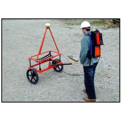
The Geomar TrackMaker61MK2 system consists of two programs: field data acquisition component (NAV61MK2) and the Windows (98/2K/XP) based data processing software (TrackMaker61MK2). The program NAV61MK2 is designed for Allegro field computer (same program designed for Pro4000 is included), although, if necessary it can be used with any other IBM compatible computer running an MS DOS operating system and equipped with two serial ports. TrackMaker61MK2 software works with virtually any GPS receiver by supporting NMEA messages: GGA, POS, GLL, LLQ, LLK, GGK, and Leica Robotics Total Station TPS1100, and collects EM61-MK2 and GPS data into one file simultaneously, while providing a graphical view of the collected GPS positions to better control the survey line direction. A profile view of the collected EM61-MK2 data is provided for the improvement of field data quality analysis.
The NAV61MK2 also provides a view of any previously collected data files with a Geonics instrument that is supported by the TrackMaker or Multi software and will assists the operator to return to previously collected stations. This allows for the easy and fast location of the last recorded positions, insert additional survey lines with finer spacing in critical areas, or simply repeat survey lines with another instrument.
In addition to acquiring EM61MK2 data the system will convert any Field PC to a stand-alone logger for GPS/DGPS data collection, taking away the need to purchase additional more expensive GPS components.
Geomar Software Inc. (formerly Geomar Geophysics Ltd.) has been developing operational software for Geonics Limited instrumentation for over 15 years. It should come as no surprise then that Geomar Software Inc. is leading the way to specialized programming for your needs; whether it be in the field of precision agriculture, environmental site characterization, unexploded ordnance (UXO) or geotechnical engineering. In the event that a program needs to be modified for your particular requirements, we will work with you.
We are committed to keeping our customers happy through our hands-on approach to solving problems, field experience, and strong technical background with the instrumentation. This is an important advantage we know we have.
Position EM61-MK2 readings and create XYZ file based on standalone NAV61MK2 file:
- Apply GPS antenna offset in any direction (as entered in the field with option of correcting this parameter during data processing)
- Selection of specific EM61-MK2 channels
- Include elevation data with correction for antenna height
- Filters the quality of positioned data based on GPS parameters as PDOP (or equivalent) and the degree of differential corrections
- Field QC parameters (Quality Indicator, number of Satellites and PDOP) are written into the generated XYZ file
- Further enhancement of the collected EM61-MK2 readings position is obtained by specifying the GPS Time Gap and GPS Minimum Interval
- Choice of coordinates in generated XYZ file: Geodetic coordinates (Latitude/Longitude in degrees) or in UTM coordinates (WGS 1984 datum in meters, feet, or US Survey feet)
Position EM61-MK2 readings and create XYZ file based on external GPS file:
(This function is used when real time GPS differential corrections are not available, or when further post processing of GPS data may improve positioning accuracy)
- Apply GPS antenna offset in any direction (as entered in the field with option of correcting this parameter during data processing)
- Selection of specific EM61-MK2 channels
- Filters the quality of positioned data based on GPS parameters as PDOP (or equivalent) and the degree of differential corrections
- Further enhancement of the collected EM61-MK2 readings position is obtained by specifying the GPS Time Gap and GPS Minimum Interval
Position EM61-MK2 readings using file in Geonics (M61) format:
(This option is used when data was originally recorded with NAV61MK2 and then converted and processed in Geonics program DAT61MK2)
- Apply GPS antenna offset in any direction (as entered in the field with option of correcting this parameter during data processing)
- Filters the quality of positioned data based on GPS parameters as PDOP (or equivalent) and the degree of differential corrections
- Further enhancement of the collected EM61-MK2 readings position is obtained by specifying the GPS Time Gap and GPS Minimum Interval
- Choice of coordinates in generated XYZ file: Geodetic coordinates (Latitude/Longitude in degrees) or in UTM coordinates (WGS 1984 datum in meters, feet, or US Survey feet)
Miscellaneous:
- Convert NAV61MK2 files to Geonics DAT61MK2 format
- Convert NAV61MK2 files to general format ASCII file
- Convert GXY file to ASCII file containing positions
- Retrieve and position field comments from NAV61MK2 file
- Apply System Time Constant delay in generated XYZ file
- Transfer data file from field computer to PC
- View NAV61MK2 file contents
