

- Home
- Companies
- SarVision B.V.
- Software
- SarVision - Forest Monitoring Software
SarVision - Forest Monitoring Software
Newspapers report almost every day about threats to forests all around the globe. Climate change results in large wildfires and pressure on land and resources lead to forest conversion at a large scale. But forest loss comes at a cost. The losses contribute to the increase of global carbon emission, ecosystem goods and services diminish, and remaining biodiversity is decreasing at an alarming rate.
While part of the forest loss is policy driven, a significant reduction is caused by illegal activities. As these occur often in large and remote areas, satellite-based monitoring is required. Due to frequent cloud cover the use of radar images that can ‘look’ through clouds is essential for a near real time monitoring of these threats.
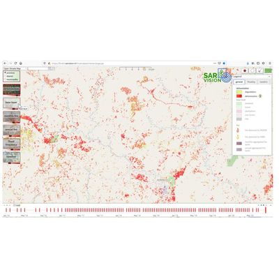
With SarVision’s automated Near Real Time Forest Monitoring System, forest changes are mapped for very large areas every 6 or 12 days at a resolution of 15 meter. Not only clear-cut areas but also forest degradation, canal and road development, floods and forest fire scars are mapped. Costs are low as use is made of free of cost radar imagery. The system allows quick response actions within two days after an image has been acquired by the satellite.
The system can easily be upscaled to any forest area in the world. With each orbit of the satellite we are able to detect deforestation everywhere.
Near real time forest monitoring
SarVision developed a Near Real Time (NRT) monitoring system for dry and peatland forest in Central Kalimantan and Riau based on a combination of free of cost Sentinel-1 radar data and L-band PALSAR data. Not only large-scale logging can be monitored, but also forest degradation (!), floods, forest fire scars, and canal and road development.
The advantage of this system in comparison to current optical-based monitoring systems is that forest change maps can be produced every 12 days with a high resolution of 15-m, and at low cost. Optical images are only sparsely available for this type of tropical forests because of a frequent cloud cover or the presence of smoke and haze. Therefore, part of the deforestation is monitored by optical systems only months after the damage has occurred. But this is not the only advantage of using radar. Radar can see more than optical systems. It can detect forest degradation caused by selective cutting which is often not picked up by optical systems due to the large time lags in available optical images and regrowth of fast-growing pioneer species that fill in the gaps. But forest degradation is an important indicator of current and future forest loss and also strongly related to a decrease of biodiversity and carbon stocks.
In addition, L-band radar is able to penetrate the forest canopy and with the help of SarVision’s advanced algorithms it is possible to monitor floods and soil moisture conditions under the tree crowns. A feature that is not possible with optical images. Note that this system is also able to detect drying out of peat forest areas and it is even possible to locate defective dams in former drainage canals that start draining the peat forest again, which leads to drought. Using this system will support fire prevention measures and will lead to huge amounts of avoided carbon emission in peat forests, especially in El Niño years.
Based on the expertise gained by SarVision with its projects in Kalimantan, SarVision also developed a fully operational and automated NRT forest monitoring system based on Sentinel-1 data only. The change detection products of this system are used by WWF for the development of its Early Warning System. Information of this system is used for the development of a predictive forest degradation model based on machine learning. The NRT forest monitoring system is now operational for entire Borneo, Surinam and Guyana and thanks to SarVision’s advanced computer systems and expertise in cloud computing the monitoring systems can easily be upscaled to other forest areas in the world.
NRT monitoring allows governments to act immediately, e.g. to send out direct response intervention teams in case of illegal deforestation. Sentinel-1 data are available from 2015 onwards and also future availability of L-band data is secured by new satellites that will become operational in the next few years (e.g. NISAR). The flow of future C-band radar data is secured by ESA for at least 20 years to come. SarVision not only provides NRT monitoring products to clients a
nywhere in the world, but also offers a technology transfer so that the system can be applied and validated by local remote sensing agencies. This provides a legal status to the monitoring products which enables authorisation of intervention activities by national and local government authorities.
SarVision is also specialised in Capacity Building related to Remote Sensing applications and has offered many training programs in several countries all over the world. Previous collaboration with KLHK and LAPAN in Indonesia has shown that operational technology transfer and effective institutional capacity building is very well possible. Similar approaches can be applied elsewhere.
Tree monitoring system
Next to its forest monitoring systems, SarVision developed a Tree Monitoring System that detects small-scale encroachment and maps individual tree felling at a resolution of 3-m, independent of cloud and haze conditions. SarVision developed and operationalized this system for test areas in the State of Pará in Brazil using a combination of TerraSAR-X, PALSAR and Sentinel-1 radar imagery. The semi-automated tree monitoring system is very accurate and can be set to a high temporal frequency (11 days) or with a lower frequency as requested. The system can easily be upscaled to any other forest area in the world.
Integrated monitoring systems
SarVision offers a multi-scale approach that complements current (optical) based systems. Radar monitoring products can be produced in such a format that they can easily be integrated with the existing monitoring products. Radar monitoring is able to increase the monitoring frequency in frequently clouded areas and can be used to monitor additional aspects that cannot be detected by optical systems alone. As high-resolution imagery is in general very costly, the radar monitoring component can also be used to localize priority areas where important changes are occurring. This will significantly reduce costs for the purchase of optical imagery.