

Planet - Planet Analytic Feeds Software
Planet Analytic Feeds harnesses the power of high-frequency, global imagery through automated, cloud-based feeds. Using advanced deep learning and computer vision techniques, Planet Analytic Feeds processes daily satellite imagery to detect and classify objects, recognize geographic features, and monitor changes over time on a global scale. The platform provides data in specific formats like GeoJSON and GeoTIFF, supporting applications such as building and road detection, automated change detection, vessel and aircraft monitoring. With a global reach, users can receive insights for their areas of interest and historical data, enabling improved decision-making processes, risk mitigation, and situational awareness with frequent updates. The system integrates seamlessly with Planet's other tools, such as their Basemaps and Tasking products, providing a comprehensive satellite intelligence solution capable of streamlining analytics for various industries including agriculture, energy, infrastructure, and defense.
Powered by deep learning and computer vision, Planet Analytics transforms daily imagery into analytic feeds that detect and classify objects, identify geographic features, and monitor change over time and around the globe.
Planet Analytic Feeds delivers data from your area of interest directly to you in GeoJSON and GeoTIFF format.
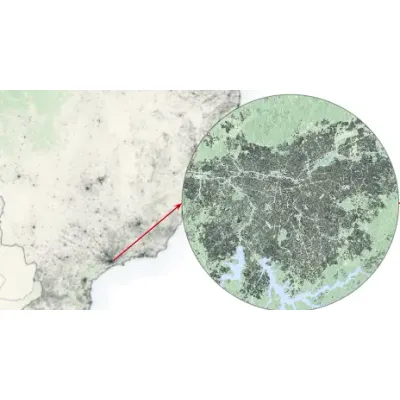
Building Detection
Monthly or weekly overview of buildings and infrastructure
Road Detection
Monthly or weekly overview of new and existing roads
Automated Change Detection
Automatic, early identification of the construction of roads and buildings
Powered by computer vision, Building Detection delivers the most consistently updated building maps at scale. With Planet Building Detection, you can:
- Update maps and charts
- Route resources more effectively
- Track urban growth and plan future development
- Gain insight across broad geographies and locations of interest
Road Detection extracts existing and new roads from Planet’s near-daily Planetscope imagery on a monthly or weekly basis, providing the data you need to:>
- Update maps and charts
- Improve routing of fleets and resources
- Gain competitive intelligence in remote locations
Let Planet’s models do the work for you with Automated Road and Building Change Detection. This option automatically extracts changes from country-wide areas, allowing you to:
- Save time monitoring broad areas of land
- Find new construction and signs of activity on a global scale
- Cost-effectively direct resources where they are needed
Powered by deep learning and computer vision, Planet Analytics transforms daily imagery into analytic feeds that detect and classify objects, identify geographic features, and monitor change over time and around the globe.
Planet Analytic Feeds delivers data from your area of interest directly to you in GeoJSON and GeoTIFF format.
Vessel Detection
Daily vessel detection across ports and coastlines around the world at 3.7 meter resolution
Aircraft Detection
Daily aircraft detection across multiple airports and airfields around the world at 3.7 meter resolution