
- Home
- Companies
- Manna Irrigation Ltd.
- Software
- Manna Irrigation - Remote Sensing ...

Manna Irrigation - Remote Sensing Irrigation and Agronomy Solutions
Growing the best crops is an art and a science. Remote sensing irrigation and agronomy software alone will not give you a complete picture without practical agronomic experience. Manna’s team of expert agronomists and irrigation specialists bring more than 40 years of expertise to your field.
We have developed and tested an agro-technic approach that produces irrigation recommendations based on a combination of remote sensing data, pin-point weather information and crop-specific models. At its core, the Manna’s model is based on the Evapotranspiration (ET) method – The model produces the observed ET of every pixel of the field, meaning the exact amount of crop water usage.
Variables from soil characteristics to local growing practices are then factored into the irrigation recommendations. Growers and consultants can even plan stress strategies using this precise and dynamic ET information or select one of hundreds of local crop protocols for dozens of crops in numerous countries from the Manna agro database (see supported crops and countries).
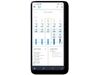
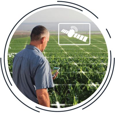
Knowing how much and when to water is an art, but also a science! Manna Irrigation Intelligence is a software solution that provides hardware-free, site-specific, daily irrigation recommendations, and crop monitoring. Manna’s software-only approach, leverages high-resolution, frequently refreshed satellite data and hyper-local weather information to deliver accessible recommendations for better Irrigation Use Efficiency (IUE) and improved crop performance.
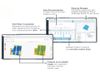
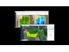
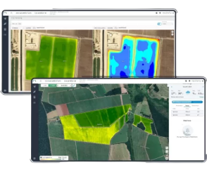
Satellites continuously measure the reflected energy in every pixel of the field. Manna`s algorithms process this data along with meteorological data to get the actual Evapotranspiration of your crop. The Evapotranspiration along with soil, weather and crop-specific agronomy inputs are used by our proprietary model to calculate the daily available water in the root zone – today and for the next 14 days! The result – actionable irrigation recommendations – when and how much water to apply.
The Manna Irrigation Intelligence system makes sense of remote sensing. Since 1999, the experts at Manna have been working to develop the best, cost-effective technologies that provide value to growers and agronomists. Our solution utilizes the significant advances in satellite technology – no more expensive, low resolution, outdated information.
We can now view every field in the world on a regular basis – and soon, every day! – providing useful, multi-spectral high resolution images. The Manna solution analyzes these images using scientific models that produce precise indicators of multiple vegetation factors that are correlated to the daily evapotranspiration and the plant’s water content in every pixel of the field.
Our solution uses data needed for the calculation of Water Demand – ET (temperature, humidity, wind, solar radiation), Precipitation, Vapor Pressure Deficit and more. Forecast is given for up to 14 days ahead and being updated every few hours, so you can plan the coming irrigation week and keep track of changes as you go. And since we have it, we also happy to share it with you… so hyper-local, precise weather info is included in our service.