
Geocledian GmbH
2 products found
Geocledian GmbH products
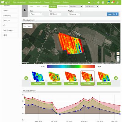
Farm Management Systems
In Farm management systems up-to-date satellite information can help to monitor the vegetation development or compare seasons and fields. Crop health problems due to pests, diseases or missing nutrients can be detected earlier. Actions can be planned and effetcs monitored.
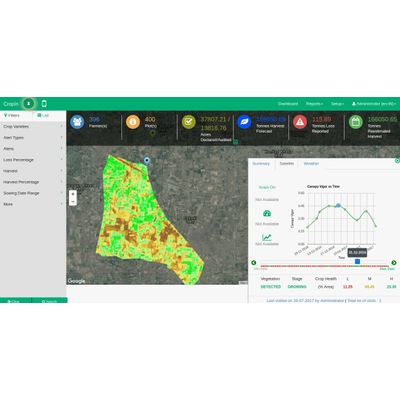
Information Systems
In different types of information systems satellite images can be used for production monitoring to get an overview about agricultural activities in a region or derive statistical information. The data can also be used to estimate for example predicted harvest, harvest loss or the area of active farmland.