

Geocledian GmbH
- Home
- Companies
- Geocledian GmbH
- Products
- Information Systems
Information Systems
FromGeocledian GmbH
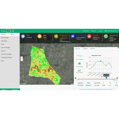
In different types of information systems satellite images can be used for production monitoring to get an overview about agricultural activities in a region or derive statistical information. The data can also be used to estimate for example predicted harvest, harvest loss or the area of active farmland.