Mapping Drone Articles & Analysis
5 news found
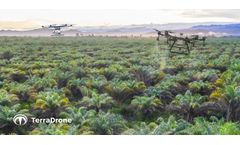
Terra Drone Corporation, a leading drone and Urban Air Mobility (UAM) technology provider, is expanding into the precision agriculture sector by acquiring the business of Avirtech, a leading startup providing agricultural drone spraying and mapping service in Southeast Asia. ...
Maps created from drone imagery are efficient tools that provide a birds-eye view of agriculture fields, revealing where problem areas might exist. ...
BySolvi AB
The Sentera Phoenix 2 is lightweight and highly durable, and may be the most precise drone available today. “The Phoenix 2 brings a level of precision and accuracy to UAVs that hasn’t been seen before,” said Todd Colten, Chief Aerospace Engineer for Sentera. ...
The Phoenix 2 is light-weight and highly durable, and may be the most precise drone available today. “The Phoenix 2 brings a level of precision and accuracy to UAVs that hasn’t been seen before,” said Todd Colten, chief aerospace engineer for Sentera. ...
RaptorMaps, which beat out seven other finalists, is building “crop-mapping” drones that fly across farmland, collecting multispectral images that, when combined with data analytics, pinpoint damaged crops. ...


