
TerraSphere Imaging & GIS B.V.
- Home
- Companies
- TerraSphere Imaging & GIS B.V.
- Services
- Actionable Data Services for Farmers
Actionable Data Services for Farmers
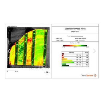
TerraSphere converts satellite imagery into actionable data. In the Netherlands, we process all satellite data for the Fieldscout App, winner of the Dutch Galileo Masters and Dutch Interactive Award. The service includes task maps for variable rate application of fertilizer, potato haulm killing, and scouting maps to analyse growth anomalies in the field. The service is also available through farm management systems at Akkerweb & DACOM.