- Home
- Software
- asia middle east
- drone software for agriculture
Refine by
Locations
- Asia & Middle East
- Afghanistan
- Armenia
- Azerbaijan
- Bahrain
- Bangladesh
- Bhutan
- Brunei Darussalam
- Cambodia
- China
- East Timor
- Georgia
- Guam
- India
- Indonesia
- Iran
- Iraq
- Israel
- Japan
- Jordan
- Kazakhstan
- Kuwait
- Kyrgyzstan
- Laos
- Lebanon
- Malaysia
- Maldives
- Mongolia
- Myanmar
- Nepal
- North Korea
- Oman
- Pakistan
- Palestinian Territories
- Philippines
- Qatar
- Russia
- Saudi Arabia
- Singapore
- South Korea
- Sri Lanka
- Syria
- Taiwan
- Tajikistan
- Thailand
- Turkmenistan
- United Arab Emirates
- Uzbekistan
- Vietnam
- Yemen
Drone Software For Agriculture Software Available In In Asia Middle East
3 software items found
by:Botlink based inFargo, NORTH DAKOTA (USA)
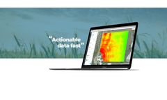
The days of scouting crop health manually is a thing of the past. Botlink’s aerial surveys deliver valuable data quickly and autonomously. Create detailed maps of your field and take action immediately. High-Definition Maps: Effortlessly photo stitch aerial images into a single, high-definition map to view your entire field. Vegetation Index: Use near-infrared photography to survey ...
by:Aerobotics, (Pty) Ltd. based inWestern Cape, SOUTH AFRICA
As your risk partner, we analyze high-resolution plant data to provide exceptional accuracy on insurable acres, meaning you’re only paying for producing planted acres and reducing the risk of rejected claims. ...
Manufactured by:Hangzhou Qifei Intelligent Technology Co., Ltd. (AGR) based inHangzhou, CHINA
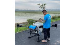
* Independent Research and Development Product, Core Technology and Exclusive Design by AGR * Foldable arms, rapid transfer. * Pluggable tank, convenient to recharge. * Applicable crops species including rice, cotton, maize, wheat, grape, cherry, orange, eggplant, peanut, sunflower, etc. * Suitable for farmers who possess 200-1000 acres of crop planting scales. * Reduce working labor costs ...


