Soil Mapping Articles & Analysis
17 articles found
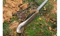
The Royal Eijkelkamp Edelman auger is used all over the world for soil sampling, traditional soil mapping and soil research. But how did this hand auger get its name? To find out we have to travel back in time, to when the first activities for soil mapping took place in the ...
The irrigation sector has a key role to play in ensuring food security in the current global context, marked by a changing geopolitical situation, climate change and the scarcity of water resources. Thus, agricultural irrigation is facing new challenges that mean irrigation associations will need to digitalize their processes. Initiatives such as Spain’s PERTE (Recovery, Transformation and ...
ByIdrica
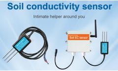
Understanding Soil EC Sensors: Soil EC sensors measure the electrical conductivity of the soil, which is an indicator of its salinity level. ...
Seeding, nutrient and irrigation management practice designs are overlaid with yield data and soil and nutrient maps. On the animal production side, there have also been many precision agriculture and technological advances. ...
ByAGRIVI
Traditional methods Current best practice involves growers installing soil moisture sensors in multiple locations (typically 1-6 sensors per 100 hectares) and interpolating to get an average reading of soil moisture across the vineyard. ...
Soil Test and Yield Map Soil Testing with a management zone or grid approach is a great way to start seeing the variability in your fields and build a plan for the future. Yield maps can help establish management zones to guide soil testing efforts. ...
For farmers with heavy, moisture-retaining soils, or slow draining areas in a field, installing drainage tile can improve overall productivity. Additional drainage tile benefits include: faster soil warm-up in the spring, less compaction, better soil aeration and overall management implications like reduced yield variation, more days of machinery ...
To obtain a map, one then has to interpolate between the samples and that means less accuracy. ...
BySolvi AB
Areas with more clayey soil have also generally higher crop potential than areas with coarser soil texture. Read more on variable rate seeding in our previous article. It may be useful to map soil variations if you are to decide how to use farm land that you have no previous experience with. ...
BySolvi AB
” He added that getting tire pressure down to at least 15 pounds per square inch (p.s.i.) is optimal for saving soil from compaction. Better monitoring tools “We believe that everything starts with the soil,” said Jordanna Kalis from SoilOptix, a company that specializes in digital high-definition top soil ...
While farms are great places to run experiments, they are also incredibly challenging places to draw reliable conclusions. Due to variability across soil type, terrain, water, nutrients, pests, and environmental stresses, the complexities can be overwhelming - even within a single field. ...
Received for publication April 15, 2009. The ability to inventory and map soil salinity at regional scales remains a significant challenge to scientists concerned with the salinization of agricultural soils throughout the world. Previous attempts to use satellite or aerial imagery to assess soil salinity have found limited ...
The yield responses were classified into potential categories with different N fertilizer requirements using apparent soil electrical conductivity (ECa), digital soil map units, and relative elevation. ...
The yield responses were classified into potential categories with different N fertilizer requirements using apparent soil electrical conductivity (ECa), digital soil map units, and relative elevation. ...
Inputs were varied according to yield zones derived from yield maps, detailed maps of soil organic matter (SOM), and sampled seasonal NO3 status. ...
Regional groundwater vulnerability maps to indicate the impact of leaching of chemicals under different management scenarios were prepared for the Rattaphum Catchment using several leaching models and GIS techniques. The Attenuation Factor (AF) model was used to simulate the leaching potential of several pesticides for selected soils in the catchment under ...
Regional groundwater vulnerability maps to indicate the impact of leaching of chemicals under different management scenarios were prepared for the Rattaphum Catchment using several leaching models and GIS techniques. The Attenuation Factor (AF) model was used to simulate the leaching potential of several pesticides for selected soils in the catchment under ...

