- Home
- Software
- north america
- precision agriculture mapping
Refine by
Precision Agriculture Mapping Software In North America
4 software items found
by:Software Solutions Integrated (SSI) , LLC based inShelbyville, ILLINOIS (USA)
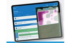
Use Agvance Mapping to provide the best advice on every aspect of the customer's precision farming operation. Mapping provides an easy-to-use web interface and leverages the power of cloud computing to provide the answers to your customers' most challenging questions. The Agvance SKY Mapping mobile app for in-field tasks puts versatility right in your hands. Soil sampling, scouting, and other ...
by:Premier Crop based inDes Moines, IOWA (USA)
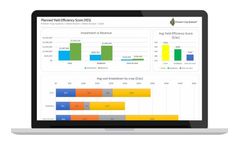
Our Yield Efficiency score is a benchmarking ROI graph that helps growers drive improvement within their operation by a visual dashboard of comparisons. Visually showing where the grower can improve in numerous different areas including profitability, seed, fertility, crop inputs and operations. ...
by:Pix4D SA based inPrilly, SWITZERLAND
Remote sensing: Collect images using a drone and any standard RGB or select multispectral cameras. You can also use Satellite Data Import to enhance your mapping experience with Sentinel-2 satellite data. Process: Process imagery with the instant processing engine and get your maps directly in the field: 6.8 GB, 2948 images, 10 min (with the new radiometry module). Scout: Generate precise ...
by:Trimble’s Agriculture Division based inSunnyvale, CALIFORNIA (USA)
Successful farmers track every detail of their operations. With lower commodity prices putting pressure on profits, and the move to precision ag adding new complexities, mobile-friendly farm management software is a requirement for farming today. Most farm software tools require users to spend hours in front of a computer — something farmers simply don’t have time for. Trimble Ag ...


