Show results for
Refine by
Farm Map Software Available In In Hungary
13 software items found
by:Fairport Farm Software based inSpearwood, AUSTRALIA
The mapping engine inside gpMapper is used as the basis of the PAM Mapping Module and our FarmStar program. To get a complete understanding of the mapping module in PAM and gpMapper. Developed from the ground up to perform at speed on today's PC's it has many new features not found in other mapping ...
by:Kingswood Computing Ltd. based inRoscrea, IRELAND
Extensive Recording Facilities for Nutrients, Grass, Fertilisers, Slurry, Sprays, Traceabilility (PCS numbers) / Nutrient Management, Budgets for Feed Wedge & Grass, Plan Rotation and Paddock Production, Link to Kingwood Herd for Breeding data, Fully PC-based – no internet/broadband access required.Use with Smartphone or PDA, Link to Farm Map, Kingswood ...
by:Field Margin Ltd. based inLondon, UNITED KINGDOM
Streamline livestock management. Record animal numbers and location on your farm map. Take control of your grazing with smart tools to monitor herd moves and pasture rest ...
by:AgroVIR Kft. based inBudaörs, HUNGARY
Make better, fact-based agronomic and financial decisions. Know at any time your stocks and how much was spent on each machine and each field. Optimize your resource usage (inputs, machines, labour, land) and be more efficient and maximize your results. Have an always up to date overview, AgroVIR grants you quick and easily accessible agronomical data and provides mobile information through ...
by:AgroVIR Kft. based inBudaörs, HUNGARY
In a growing modern farm operation where you have to consolidate data from multiple companies and track the financial performance of various branches or departments it's easy to get entangled in the numbers. AgroVIR is an integrated system always at your service, that just simply works and is easy to use for always having an up-to-date overview and handling all kinds of transactions of an ...
by:365FarmNet GmbH based inBerlin, GERMANY
How often and when you should combat Septoria leaf blotch on your winter wheat largely depends on weather conditions and disease susceptibility of the variety. With the assistance of the ISIP Septoria forecast improve your control strategy now through automatic determination of the optimum time for the fungicide application. The daily, site- specific calculation of the risk of infection on the ...
by:Safe Ag Systems based inGlenelg, AUSTRALIA
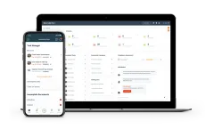
A user-friendly, intuitive, and practical software solution. Digitise your record keeping, improve productivity and future proof your farming business with a more convenient ...
by:Field Margin Ltd. based inLondon, UNITED KINGDOM
Keep track of fruit and vegetable production on the go or from the office. Easily share planting areas, jobs and issues with your team, and track work progress and ...
Manufactured by:Halltech Environmental and Aquatic Research Inc. based inGuelph, ONTARIO (CANADA)
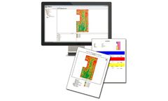
Farm Works View is a free desktop software that allows to easily view precision farming data and recorded data from Farm Works Mobile. View supports all types of data from planting to harvest, providing powerful maps and reports that help make better farm management ...
by:Farmnxt Inc. based inOttawa, ONTARIO (CANADA)
Open cultivation is a conventional method of farming. The vast majority of farmers grow produce in open fields. This farming method has its own set of challenges. Farmers have to cope with changes in climate, fluctuations in nature, pest and disease attacks, eroding soil health and depleting water tables. In order to be competitive in global scenarios, farmers need more than ...
by:Map My Crop based inNew York, NEW YORK (USA)
The accurate delineation of land boundaries is a critical step in identifying land-use and planning their management. Particularly for croplands, this delineation enables farmers and agribusinesses to better estimate the land area for the efficient use of agri-inputs, such as seeds, pesticides, fertilisers, and other resources and to optimise production and post-production ...
by:Pix4D SA based inPrilly, SWITZERLAND
Remote sensing: Collect images using a drone and any standard RGB or select multispectral cameras. You can also use Satellite Data Import to enhance your mapping experience with Sentinel-2 satellite data. Process: Process imagery with the instant processing engine and get your maps directly in the field: 6.8 GB, 2948 images, 10 min (with the new radiometry ...
by:Trimble’s Agriculture Division based inSunnyvale, CALIFORNIA (USA)
Successful farmers track every detail of their operations. With lower commodity prices putting pressure on profits, and the move to precision ag adding new complexities, mobile-friendly farm management software is a requirement for farming today. Most farm software tools require users to spend hours in front of a computer — something farmers simply don’t have time for. Trimble Ag ...

