Refine by
Drought Software
12 software items found
Manufactured by:A.U.G. Signals Ltd. based inToronto, ONTARIO (CANADA)
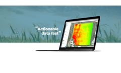
This can help to investigate different situations such as fungal infections and take the right actions. Vegetation growth features can assist in determining famine severity, drought conditions, and impacts on yields; in a result, the authority is able to anticipate food shortages and commodity price fluctuations in a more accurate ...
by:Satyukt Analytics Private Limited based inBengaluru, INDIA
Its soil health analysis feature provides macro-level insights into soil conditions, including macronutrient levels, SOC, and pH, reducing the need for traditional soil sampling. The soil moisture estimation component helps address drought challenges by integrating satellite data into management strategies, promoting resilience and sustainable water resource ...
by:AgroScout based inKibbutz Yiron, ISRAEL
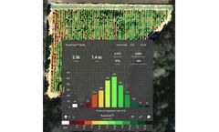
Get a complete overview of your field with AgroScout’s Orthomosaic photos function with a resolution of 1 cm/pixel. Our platform compiles and stitches together photos from the autonomous drone missions to give you the full picture of what’s happening in your field. With the Walk-to-the-Plant mobile feature, use the geo-tagged photos to find a specific plant out in the field, even when ...
by:QZ Solutions Sp. z o.o. based inOpole, POLAND
Invest in monitoring your customers’ crops – knowledge that pays off. RSPalert allows us to monitor changes in crop plants, determine their condition and stress using satellite ...
by:3a Srl based inTorino, ITALY
An integrated information system to increase the resilience and sustainability of rural economies. Decision support (DSS) for agricultural production (phytosanitary defense and irrigation) in order to mitigate the environmental impact of productions. Rural economies are strongly affected by a technical change in the production of agricultural ...
by:Botlink based inFargo, NORTH DAKOTA (USA)
The days of scouting crop health manually is a thing of the past. Botlink’s aerial surveys deliver valuable data quickly and autonomously. Create detailed maps of your field and take action immediately. High-Definition Maps: Effortlessly photo stitch aerial images into a single, high-definition map to view your entire field. Vegetation Index: Use near-infrared photography to survey ...
by:Atfarm based in, UNITED KINGDOM
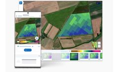
Biomass Comparison allows you to see how the variability of your field has changed from week to week, month to month, or even year to ...
by:VineView based inHalifax, NOVA SCOTIA (CANADA)
Maximize your grape quality and yield with the world’s most advanced measurement of vine health. With VineView’s suite of scientifically-calibrated vine vigor maps you get insightful, timely information to improve grape quality and yield, and reduce costs associated with: Harvest Segmentation; Locate areas in your parcels to increase and improve the production of premium grapes and ...
by:Regent Instruments Inc. based in, QUEBEC (CANADA)
WinCAM NDVI is an image analysis system which can do various types of measurements, most of them color or NDVI related (CAM = Color Area Meter). For various objects or scenes it can quantify color clusters of interest, measure objects morphology and classify objects based on color content, quantify color uniformity or aggregation, do profilometry analyses (color variation along path lines) and ...
by:Kheti Buddy based inPune, INDIA
Rethink remote sensing by sensitizing it for agricultural practices. Are you looking for a way to make better, more informed decisions on the farm? Introduce GIS to your precision farming process – a technology that can help you visualize data and analyze spatial information for improving and optimizing farming processes. With GIS, you can monitor the health of individual crops, estimate ...
by:SarVision B.V. based in, NETHERLANDS
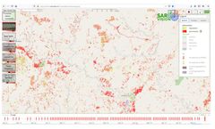
Newspapers report almost every day about threats to forests all around the globe. Climate change results in large wildfires and pressure on land and resources lead to forest conversion at a large scale. But forest loss comes at a cost. The losses contribute to the increase of global carbon emission, ecosystem goods and services diminish, and remaining biodiversity is decreasing at an alarming ...
by:QuickTrials, a Part of RESONANZ Group based inWollerau, SWITZERLAND
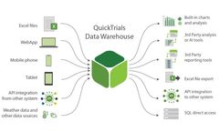
QuickTrials is a leading Software-as-a-Service (SaaS) platform for planning, executing, monitoring and analysing agricultural field trials. It’s an end-to-end solution that reduces the cost of conducting trials, helps to speed up innovation, and is used by major organisations around the ...

